
|
The Modern Antiquarian Forum » Wirral Megalithic Sites |
Log In to post a reply
|
|
|
|
| Topic View: Flat | Threaded | |
|
david gregg 15 posts |
Nov 19, 2017, 11:10
|
||
|
Several suggestions have been made over the years about ancient stone sites on the Wirral. I have now investigated three based on OS map analysis : the Overchurch site at Upton; the Arrowe Park site; the Fender Lane, Bidston site. The first two appear to host large stone circles. At Overchurch Hill 7 stones accurately lie on a true circle of ~1176 ft diameter. Four stones define two sectors of an inscribed hexagon. The graveyard platform of the Norman church also has interesting geometry. At Arrowe Park there are two concentric circles and a third circle and all together 13 stones seem to be involved. The inner circle also appears to host hexagonal geometry. At Fender Lane Bidston the old maps show 3 linear rows of stones more or less north south. In total there was once an array of 42 stones over 1250 ft long. At all three sites analysis shows many alignments to sun and moon rising and setting events far beyond chance. If anybody is interested or has done work on these sites please contact me. I am publishing a short book on these sites. Professor D P Gregg (retired)
|
|||
|
Evergreen Dazed 1881 posts |
Nov 19, 2017, 12:02
|
||
|
david gregg wrote: At Overchurch Hill 7 stones accurately lie on a true circle of ~1176 ft diameter. 1176ft would make it larger than Avebury and therefore the largest stone circle in the world. If only Norris McWhirter were still with us. Putting to one side that the vast majority of stone circles are not true circles, could you explain why you think these 7 stones are a prehistoric stone circle? If its because - david gregg wrote: At all three sites analysis shows many alignments to sun and moon rising and setting events far beyond chance. Then could you tell me which 'sun and moon rising and setting events' have you found at Overchurch?
|
|||
|
david gregg 15 posts |
Nov 19, 2017, 13:13
|
||
|
Hello. I used compass and direct measurements on the 25 inch to the mile OS maps of 1872 for Overchurch and Arrowe Park and the 6 inch to the mile OS maps at Bidston. We have true circles not ellipses or 'eggs'. If you don't accept this get the maps and check yourself. As for scale the inner circle at Arrowe Park has a diameter of ~2300 ft...and yes I am quite aware this exceeds Avebury having studied that site closely. On alignments they all seem to be there : summer solstice sunrise, winter solstice sunrise, equinoxes, etc. Major and minor standstill moonrise points of the 18.6 year nodal cycle, equinox moonrises and settings...and reciprocals to sun and moon set. If all this is too much to swallow look at the evidence: see my book 'The Overchurch Mystery'. Professor D P Gregg (retired)
|
|||
thesweetcheat 6209 posts |
Nov 19, 2017, 15:09
|
||
|
Hi and welcome David, Just picking up on the methodology of using the Ordnance Survey as a basis for your measurements, particularly the very small scale 6 inch map (1/10560). I'm sure you're aware of all of this, but the thickness of a line on the 6 inch map equates to about 10 feet in width, so using a map of that scale as a basis for a survey of stones (that are presumably a couple of feet wide) is problematic. An error of a millimetre in your placement on a 1/10560 map would move the stone about 20 feet (sorry for mixing metric and imperial!). The modern OS map at 1/2500 (equivalent to the 25 inch map) has a relative accuracy of a couple of metres. Rather less for a 25 inch map surveyed using chains back in say the 1950s. A couple of metres accuracy is obviously pretty good for a map that you want to show the relative position of buildings, roads, etc, but not so good if you want accurate placement of a smallish stone in a big circle. So if you've taken measurements on the ground and plotted them onto a 25 inch (or 6 inch) map, depending on how you've done the surveying and whether the ground slopes, which of the features on the map you have chosen to "fix" your measurements against, etc, you can plot your stone confidently to about 2 metres of where it actually is on the 25 inch, but probably only to 10 metres or so on the 6 inch (I'm not sure what the tolerances and relative accuracy of a 6 inch map would be, but quite low). That still leaves quite a degree of variation to accurately plot the circle with confidence to show a "true" circle. This gets even worse if the distance between the stones is considerable, which your measurements for the circle's diameter would indicate.
|
|||
|
Evergreen Dazed 1881 posts |
Nov 19, 2017, 19:09
|
||
|
david gregg wrote: Hello. I used compass and direct measurements on the 25 inch to the mile OS maps of 1872 for Overchurch and Arrowe Park and the 6 inch to the mile OS maps at Bidston. We have true circles not ellipses or 'eggs'. If you don't accept this get the maps and check yourself. As for scale the inner circle at Arrowe Park has a diameter of ~2300 ft...and yes I am quite aware this exceeds Avebury having studied that site closely. On alignments they all seem to be there : summer solstice sunrise, winter solstice sunrise, equinoxes, etc. Major and minor standstill moonrise points of the 18.6 year nodal cycle, equinox moonrises and settings...and reciprocals to sun and moon set. If all this is too much to swallow look at the evidence: see my book 'The Overchurch Mystery'. Professor D P Gregg (retired) Love it!
|
|||
Sanctuary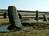 4670 posts |
Nov 19, 2017, 21:23
|
||
https://s3.eu-west-2.amazonaws.com/sheetlines-articles/Issue95page47.pdf
|
|||
|
thesweetcheat 6209 posts |
Nov 19, 2017, 22:05
|
||
|
Thanks, useful to see that context. It's worth mentioning that the Ordnance Survey didn't employ any archaeologists until the 1920s, and "stone" on a map in non-antiquity typeface means just that, a stone. It didn't have to be standing, or have anything to indicate artificial placement. It was just a stone big enough to warrant someone noticing it. I'm sure there were guidelines about how big a stone had to be to show, but I'm also fairly certain that different surveyors/draughtsmen interpreted the guidelines slightly flexibly! None of which is to dismiss the idea that there could have been circles, just to point out that in itself a "stone" appearing on a 19th century 6 inch map is a pretty unreliable basis for a theory without something else to support it.
|
|||
|
Evergreen Dazed 1881 posts |
Edited Nov 22, 2017, 06:00
Nov 19, 2017, 23:46
|
||
**
|
|||
moss 2897 posts |
Nov 20, 2017, 09:06
|
||
|
thesweetcheat wrote: Thanks, useful to see that context. It's worth mentioning that the Ordnance Survey didn't employ any archaeologists until the 1920s, and "stone" on a map in non-antiquity typeface means just that, a stone. It didn't have to be standing, or have anything to indicate artificial placement. It was just a stone big enough to warrant someone noticing it. I'm sure there were guidelines about how big a stone had to be to show, but I'm also fairly certain that different surveyors/draughtsmen interpreted the guidelines slightly flexibly! None of which is to dismiss the idea that there could have been circles, just to point out that in itself a "stone" appearing on a 19th century 6 inch map is a pretty unreliable basis for a theory without something else to support it. Interesting, it brought to mind quite a few stones randomly recorded near to the Bitton Barrow and the river. The stones disappeared at a later date under a sewage plant but they always intrigued me. So I shall add this lost piece of information gleaned from the map to the Bitton Barrow http://www.themodernantiquarian.com/site/5494/bitton.html, though the stones seem to have no logic, history has laid them alongside a Roman road, which would seem to prove that earlier settlements existed. Thank you for making me go back and visit an old 'theory'.... http://maps.nls.uk/geo/explore/#zoom=16&lat=51.4175&lon=-2.4674&layers=6&b=1
|
|||
|
david gregg 15 posts |
Nov 20, 2017, 12:36
|
||
|
Hello. Thanks for your comments on uncertainty. There are several sources of uncertainty on such sites. 1. the original layout of the stones over long distances using ropes or pacing dividers. 2. the errors of surveying by the OS mappers. 3. errors in my measurements using the 25 inch maps. However providing the errors are not systematic they should not significantly distort the intended figure...in these cases the intention was clearly to create true circles. The probability of finding 7 stones (of 9 stones in the area) lying on such a circle by accident is minute at Overchurch. The multiple circle layout at Arrowe Park is even less likely to appear by chance. I do not have the space here to explain statistical theory. Please see my book. The point about OS mappers sometimes including all stones in an area is valid. However that makes it even less likely that a group of stones would happen to form a geometrical figure on the ground. Professor D P Gregg
|
| Pages: 3 – [ 1 2 3 | Next ] | Add a reply to this topic |
|
|
|
| The Modern Antiquarian Forum Index | |